This page will build your awareness and knowledge of important areas around Stevens Pass. As a new or returning staff, understanding the most appropriate paths, areas for teaching, and safety zones is imperative for creating experiences of a lifetime. The insider knowledge or where to go is usually learned over a long period of time and much experience. And through collaboration we have created maps to share this knowledge with you.
Explore all of the tabs to learn more about the mountain!
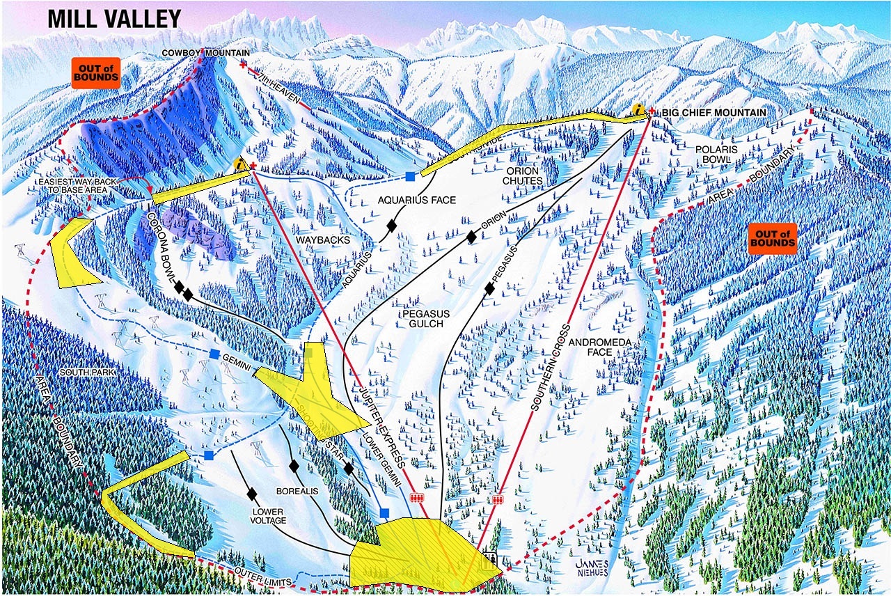
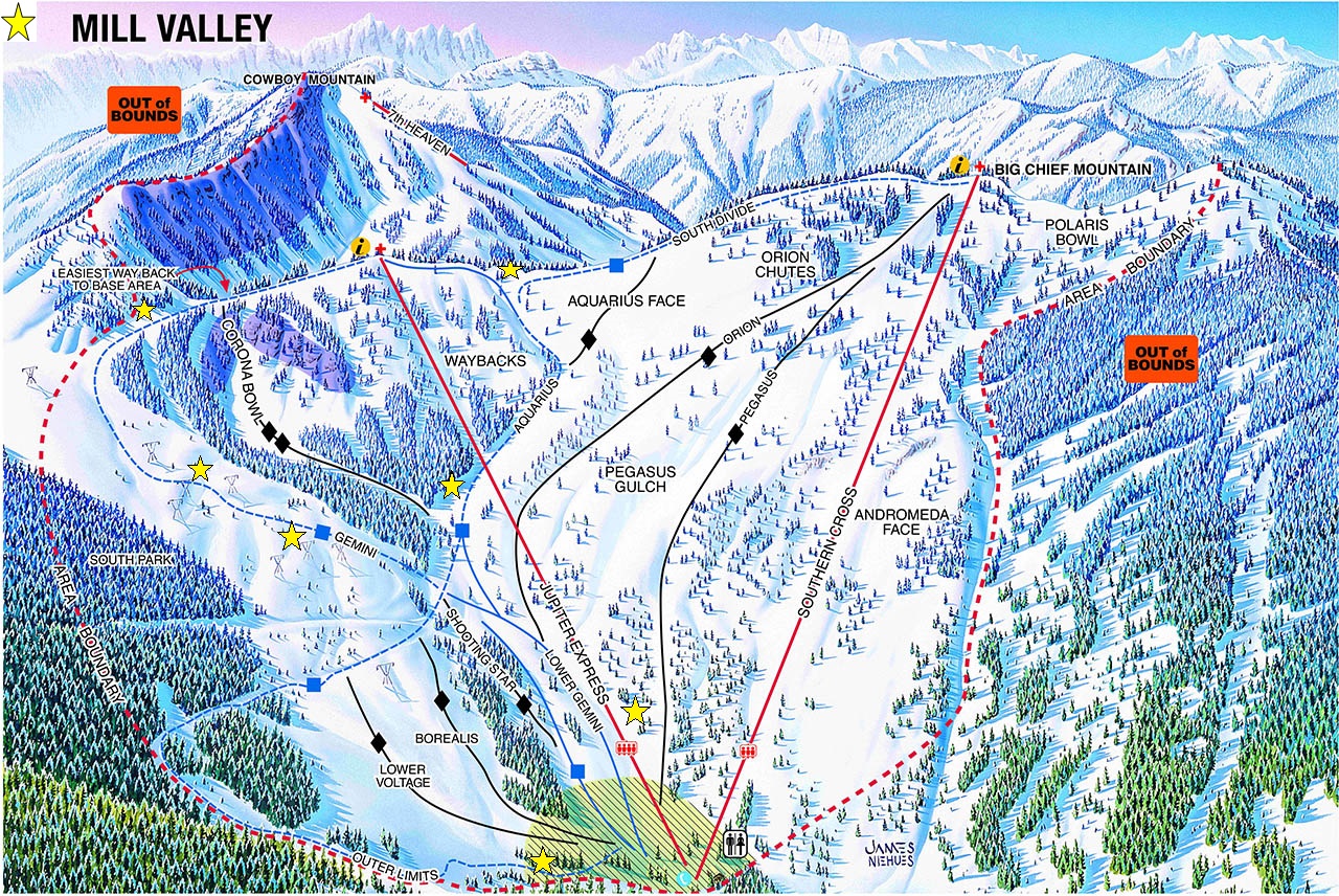
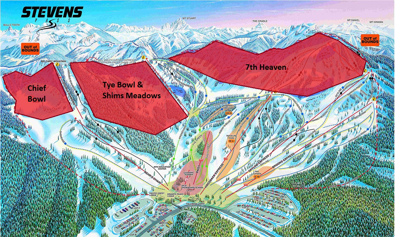
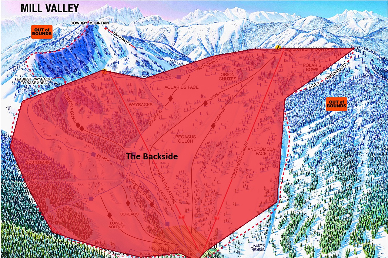
These are areas in which you are focusing on continually moving your guests from point A to Point B and safely making your way to your destination. Do not stop within these areas unless in an emergency. They are high traffic areas that consistently have heavy cross traffic or merges and are areas where incidents are more likely to occur. Spatial Awareness should be at the highest level at all times, but especially when in and around these zones. Consider your safety and that of others around you as you make decisions on how to flow through these zones FRONTSIDE BACKSIDE Designated routes are those groomed trails where staff who are able to ski and ride for work are able to do so off the clock in uniform or on a work assignment that does not involve students. These are paths that are often the easiest way down and away from heavy traffic flow when possible. *There are no designated routes on the backside. FRONTSIDE FRONTSIDE BACKSIDE LEARNING AREA Below is a map of the Learning Area and the safe stopping spots or eddies within it. Use these safe locations when grouping up or delivering a quick message before entering the flow. During rare weather events or when conditions on large areas of the mountain are unsafe the Ski and Snowboard School will communicate to staff when they are not allowed to take lessons to these Access Management Zones. See map below for details: FRONTSIDE BACKSIDE Flow Through Zones
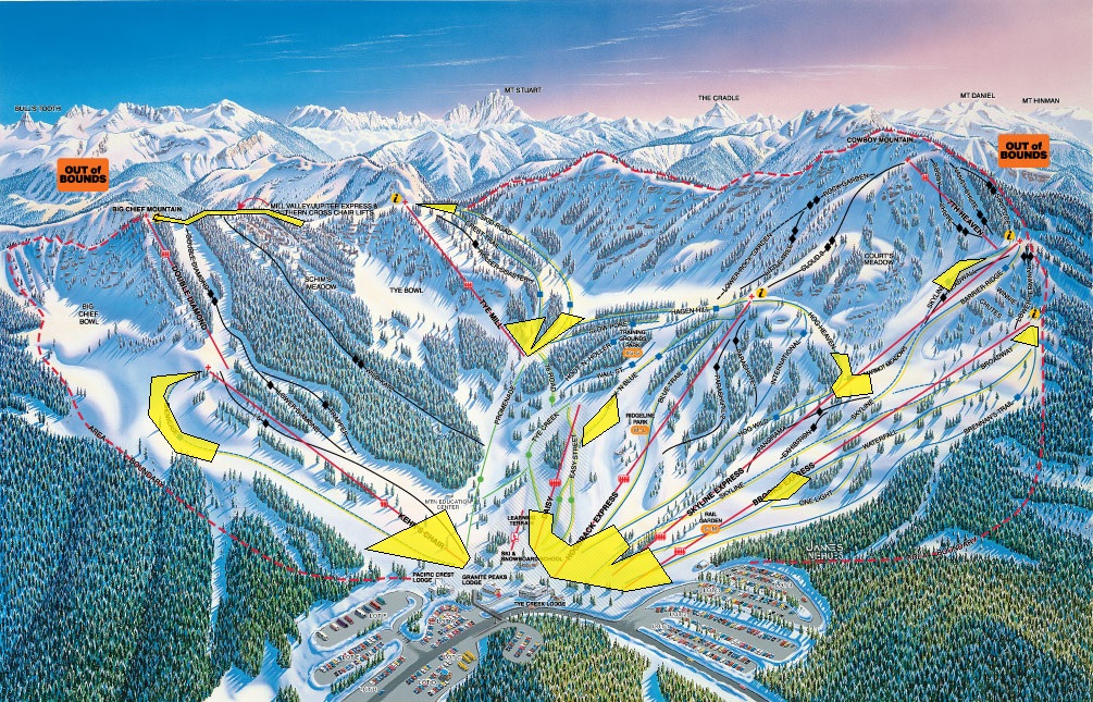
Designated Routes

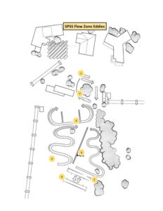
Safe Stopping Spots
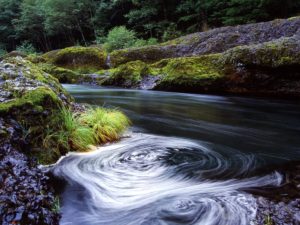 The definition of an eddy: a circular movement of water, counter to a main current, causing a small whirlpool. What does this have to do with skiing? We can look to use areas out of the flow of traffic as stopping spots for our group when leading lessons.
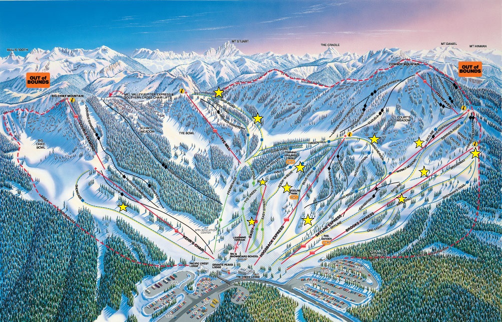
Access Management Zones
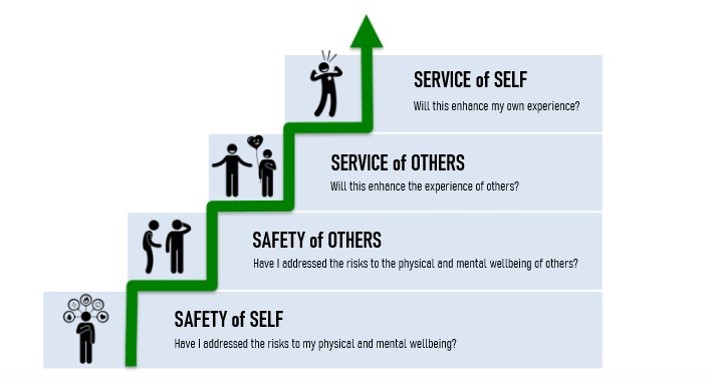
Decision Making Model
To help you use these maps and information more effectively, put all of your decisions through this filter:
Watch this video to learn more!
If you have a suggestion for more informational maps, please let us know at SPSchoolStaff@vailresorts.com